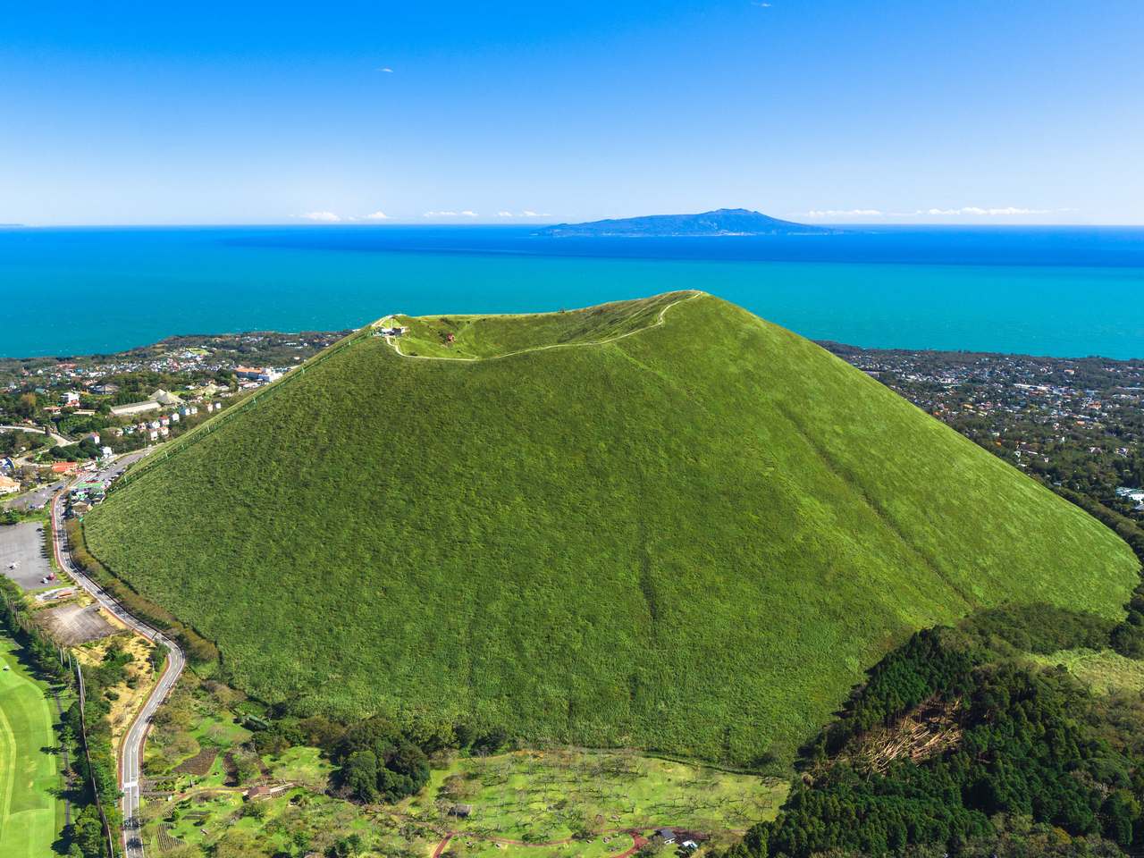
In the eastern part of the Izu Peninsula, there are countless small volcanoes. Mt. Omuro is the largest volcano among them and is characterized by a pudding-shaped hill made of accumulated ejecta. From the top of the mountain, you can overlook the Sagami Sea and the Izu Islands, and if the weather is good, you can see Mt. Fuji, Hakone, the Shonan coast, the Miura Peninsula, and the Southern Alps in further distance.
| |Area | Eastern Izu Area (Ito City) |
| |Geological Period | Mt. Omuro erupted about 4,000 years ago (the largest scoria hill in the eastern Izu volcanic group) |
| |Itinerary | Omuroyama Lift Sanroku Station → Lift Ride→ Omuroyama Summit Station→ Crater Rim Walkway→ Lift Ride→ Sanroku Station→ Sakura no Sato→ Sakura no Sato Parking Lot |
| |Distance | Approx. 2.4km |
| |Duration | Approx. 120 minutes |
| |Level | Light hiking |
| |Meeting Point | Omuroyama Lift Sanroku Station At the Red Shrine Gate <MAP> |
| |Meeting Point | Omuroyama Lift Sanroku Station (same as meeting point) |
| |Participation Fee | Adults (junior high school students and older): 3,000 yen Elementary school children: 1,500 yen * A separate lift fare will be charged. (1,000 yen as of January 2025) |
| |Number of Participants | 1 to about 10 people * 1,000 yen more for 1 person |
| |Reservation | Please make a reservation at least one week in advance. |
| |What to Wear/ bring | Comfortable clothing, footwear (no sandals), hats, drinks, etc. * It can be chilly at the top of the mountain in spring and autumn. Bringing jackets would be convenient. |
| |Notes | The tour will be cancelled in case of strong winds and lift services are suspended (even in sunny weather, the lift will be suspended when the wind speed exceeds a certain level.) There is a lift inspection for about one week in the middle of June and December every year, and at that time, the service will be suspended. The length of the closed period varies every year, so please check the Omuroyama Lift website. Please read about the cancellation policy. |
| |How to Apply | Please apply from the "Reservation Form" at the bottom of the page. |
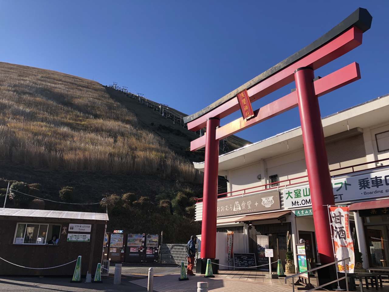
Omuroyama Lift Sanroku Station
The meeting point is in front of the red Shrine gate in the first parking lot (please wait in the covered passage in case of strong winds or light rain).
↓
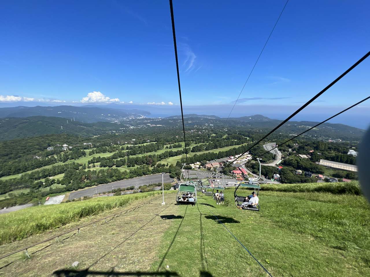
Omuroyama Lift
You will take a pleasant aerial walk for 6 minutes by a pair lift to the summit. Please enjoy the excitement of going up and panoramic superb view on the way down.
↓
Mt. Omuro
Mt. Omuro is a small pudding-shaped volcano formed by the accumulation of ejecta from eruptions.
↓
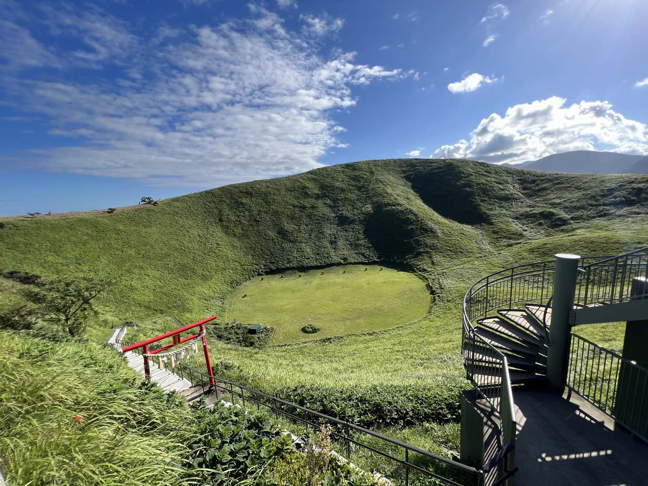
Crater
On the summit of Mt. Omuro is a crater where scorching magma once erupted like a fountain. At the red shrine gate on the bottom left is Asama Shrine.
↓

Mt. Omuro
The largest scoria hill in the eastern Izu volcanic group. From the summit, you can see unique monogenetic volcanoes with various shapes, such as Mt. Komuro, Lake Ippeki, and Mt. Yahazu. Below you, you can enjoy watching the varied terrain formed by the lava of Mt. Omuro like the Izu Kogen, and the Jogasaki Coast.
↓
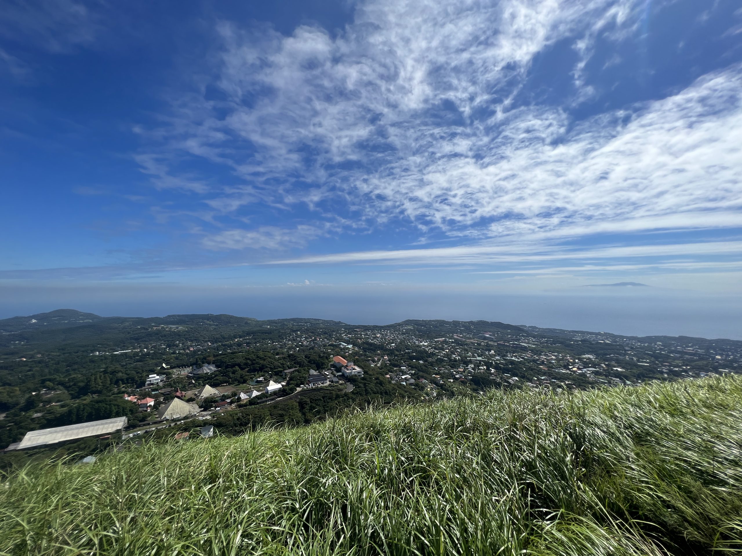
Summit view (seaside)
You can see the Jogasaki Coast created by the lava flow from Mt. Omuro. You will have the view of Hatsushima, Izu Oshima, Toshima, and Niijima in the Sagami Sea.
In addition, if the conditions are good, you will see Kozushima and Miyakejima, and you will even see the buildings of Yokohama, the Miura Peninsula, and the Boso Peninsula.
↓
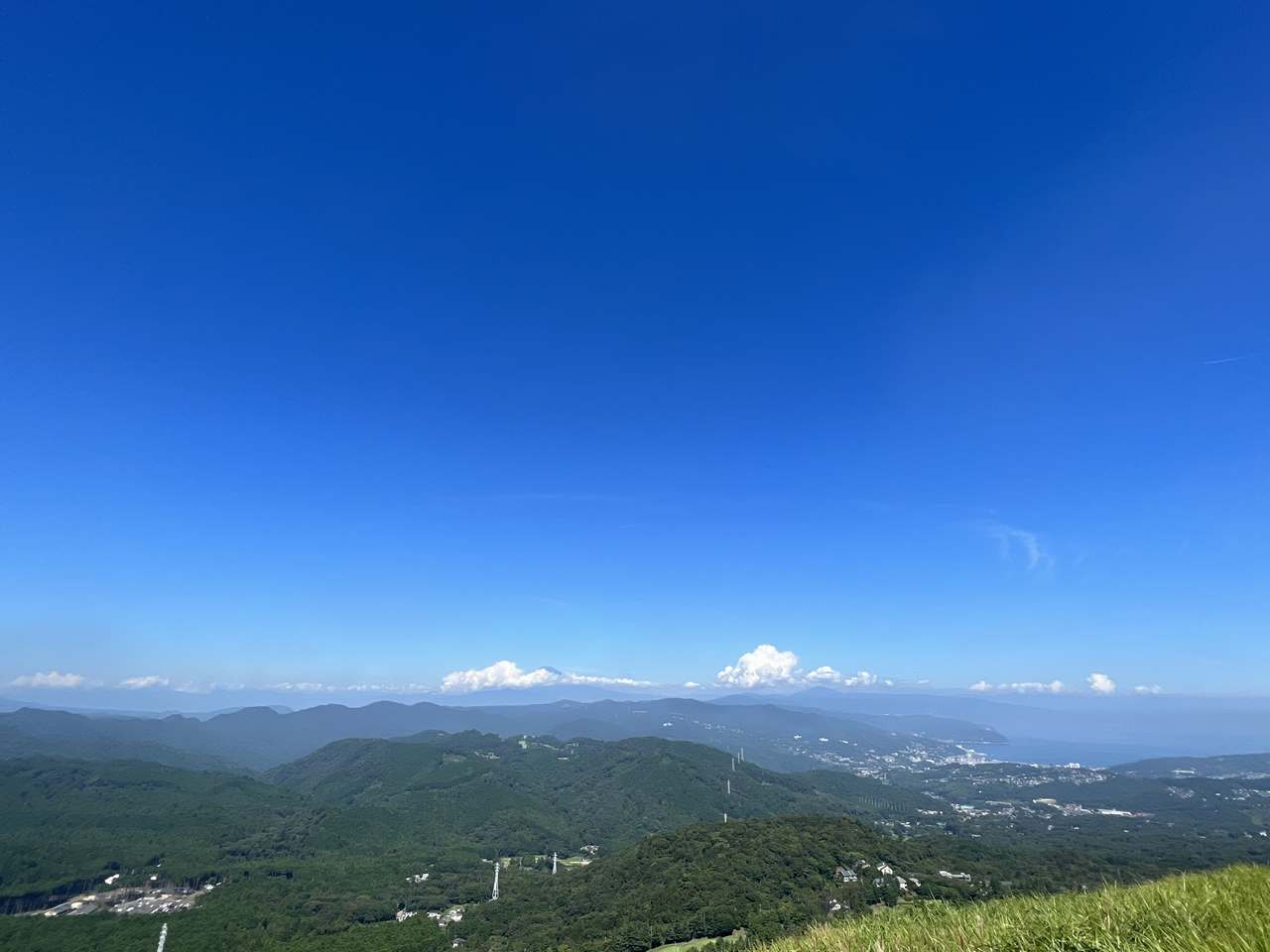
Summit view (mountainside)
To the south, you can see the Amagi mountain range, the highest peak in Izu.
If you look north, you can see Mt. Fuji, Hakone, and even the Southern Alps if the conditions are good.
↓
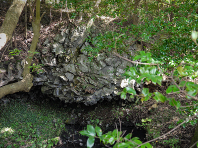
Sakura no Sato: Scoria Raft
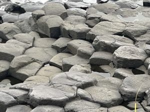
At the foot of Mt. Omuro, "Sakura no Sato" is full of cherry blossoms in all four seasons. Here you can see a natural formation called "scoria raft" where scoria coated with lava looks like omelet rice.
↓
Ananohara Lava Cave
A round vertical hole created by the collapse of the ceiling of a cave created by lava flow. We will look down on it from above.