Lake Ippeki and the adjacent Numa Pond are lakes formed by the accumulation of groundwater that gushed out in a crater formed by an explosive eruption about 100,000 years ago. Long after the formation of Lake Ippeki, lava flowing from Mt. Omuro flowed into the lake and reclaimed part of the lake, creating the Twelve Islands. It now maintains a rich ecosystem, but you can also see traces of violent explosions in the past. The colored leaves are beautiful in autumn, which is rare on the warm Izu Peninsula.
| |Area | Eastern Izu Area (Ito City) |
| |Geological Period | Lake Ippeki and Numa Pond formed by an explosive eruption 100,000 years ago among the activities of the eastern Izu volcanic group |
| |Itinerary | Lake Ippeki Parking Lot→ Outcrop where breccia can be seen → Numa Pond→ Sightseeing Bridge→ Lawn Square→ Lake Ippeki Parking Lot |
| |Distance | Approx. 3km |
| |Duration | Approx. 120 minutes |
| |Level | Hiking |
| |Meeting Point | Lake Ippeki Parking Lot <MAP> *Free parking. |
| |Ending Point | Lake Ippeki Parking Lot (same as meeting point) |
| |Participation Fee | Adults (junior high school students and older): 3,000 yen Elementary school children: 1,500 yen |
| |Number of Participants | 2 to about 10 people |
| |Reservation | Please make a reservation at least one week in advance. |
| |What to Wear/ bring | Comfortable clothing, footwear (no sandals), hats, drinks, etc. |
| |Notes | The tour will be operated in case of light rain, but in case of stormy weather it will be cancelled. Please read about the cancellation policy. |
| |How to Apply | Please apply from the "Reservation Form" at the bottom of the page. |
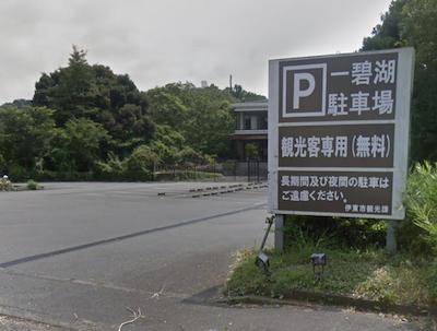
Lake Ippeki Parking Lot
Free tourist-only parking.
This is the meeting point.
↓
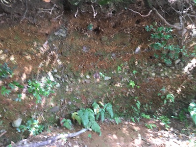
Outcrop where Breccia can be Seen
You can see fragments of rock that were shattered into pieces during the explosive eruption that formed Lake Ippeki and Numa Pond.
↓
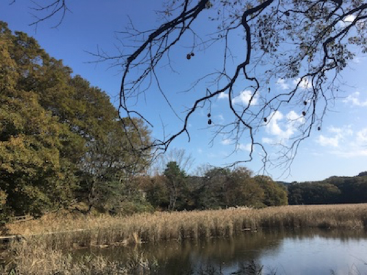
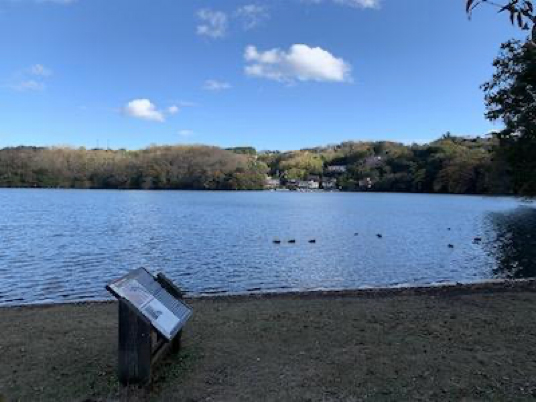
Numa Pond
It used to be a large pond like Lake Ippeki, but it has been reclaimed by lava that flowed in when Mt. Omuro erupted and sediment carried by rain from the surrounding area, and now it looks like a shallow wetland.
↓
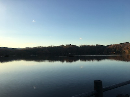
Lake Ippeki Seen from the Sightseeing Bridge
A sightseeing bridge over a narrow waterway that connects Lake Ippeki and Numa Pond. From here, you can see the entire lake, and you can see that the lake is almost a circular crater.
↓
Twelve Islands Seen from the Lawn Square
From the lawn square, you can see the Twelve Islands up close. From the sightseeing bridge, it looked like a peninsula, but from here you can see that it is a row of several islands. It is the remains of lava that flowed out in large quantities during the eruption of Mt. Omuro 4,000 years ago and buried part of the lake.