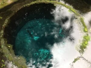
From Shishihama to Kuchino in Numazu City, you can see ejecta caused by activity on shallow submarine volcanoes 10 million years ago ~ 2 million years ago (Shirahama Formation). Solid stones solidified in the path of lava can be seen with numerous columnar joints formed by regular cracks. The volcanic ash accumulated on the seabed shows beautiful stripes. These Izu stones have been used as materials for building structures.
| |Area | Northern Izu Area (Numazu City) |
| |Geological Age | Submarine volcanic ejecta that erupted on a shallow seabed 10 million years ~ 2 million years ago |
| |Route | Numazu Cycle Station “Shizuura Higashi” → <Bus Transfer> →Shizuura District Center→ Enoura Bay (along National Route 414) → Nunoshima (Shishihama) → Stone Quarry Ruins→ Enoura Cave Tombs → Naval Base Ruins→ Tabi Tunnel (old and new), →Kano River Flood Control Channel→ Kuchino Passage→ Numazu Cycle Station “Shizuura Higashi” |
| |Distance | Approx. 3km (Cumulative elevation 70m) |
| |Duration | Approx. 150 minutes |
| |Difficulty | Strolling around the city |
| |Meeting Place | Numazu Cycle Station “Shizuura Higashi” <MAP> |
| |Ending Place | Numazu Cycle Station “Shizuura Higashi” (same as meeting point) |
| |Participation Fee | Adults (junior high school students and older): 3,500 yen Elementary school children: 1,750 yen |
| |Number of Participants | 2 to about 10 people |
| |Reservation | Please make a reservation at least one week in advance. |
| |What to Wear/Bring | Comfortable clothing, footwear (no sandals), hats, drinks, etc. |
| |Notes | The tour will be operated in case of light rain, but in case of stormy weather it will be cancelled. Please read about the cancellation policy. |
| |How to Apply | Please apply from the "Reservation Form" at the bottom of the page. |
Numazu Cycle Station “Shizuura Higashi”
This is the meeting point.
↓
Shizuura District Center
Immediately to the south was a hill called Okubo no Hana, but it was carved by quarrying and turned into a small lowland.
↓
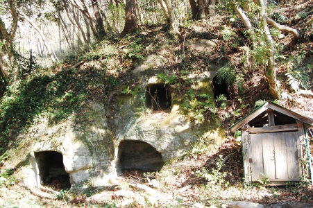
Enoura Cave Tombs
They are tombs constructed by digging tuff by ancient people.
↓

Kano River Flood Control Channel
It was completed in 1965 and is designed to deal with big flood damage of the Kano River typhoon class. You will see the outlets of water to the sea.
↓
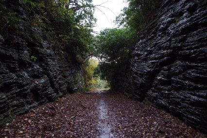
Kuchino Passage
It is a narrow road constructed by cutting through the tuff cliff. On both sides of the cliff, you can see geological formations since when the Izu Peninsula was a group of submarine volcanoes.